Land Degradation Assessment in Drylands (FAO-LADA)
The Land Degradation Assessment in Drylands (LADA) project's general purpose was creating the basis for informed policy advice on land degradation at the global, national, and local levels.
- Home
- Land Degradation Assessment in Drylands (FAO-LADA)
About the project
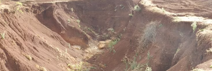
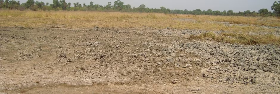
Land degradation is a severe and widespread environmental problem, and is tackled by the United Nations Convention to Combat Desertification, the Convention on Biodiversity, and the Kyoto Protocol on Global Climatic Change. However, there is no authoritative measure of land degradation and countervailing land improvements. There is pressing need for an up-to-date, quantitative, and reproducible assessment to support policy development for food and water security, environmental integrity, international aid programmes, and national strategies for economic development and resource conservation.
The Land Degradation Assessment in Drylands project (LADA) was a five-year project developed by the Food and Agriculture Organization of the United Nations (FAO), the United Nations Environment Programme (UNEP), and the Global Environment Facility (GEF). One of its major tasks was to prepare a Global Land Degradation Assessment map to replace the outdated GLASOD (Global Assessment of Human-induced Soil Degradation) evaluation produced by UNEP and the World Data Centre for Soils (ISRIC) in the early 1990s. LADA ran from 2006 to 2010.
With respect to new developments in monitoring land degradation, FAO, UNEP, and other partners – including WOCAT – worked towards a more comprehensive and scientifically based global assessment of land degradation through the LADA project. LADA was funded by GEF. Among other objectives, LADA aimed to identify “hot spots” (problem areas) and “bright spots” (conservation successes). The WOCAT Network and its database and publications fed into the LADA process by providing numerous examples of these “bright spots” or “green spots”.
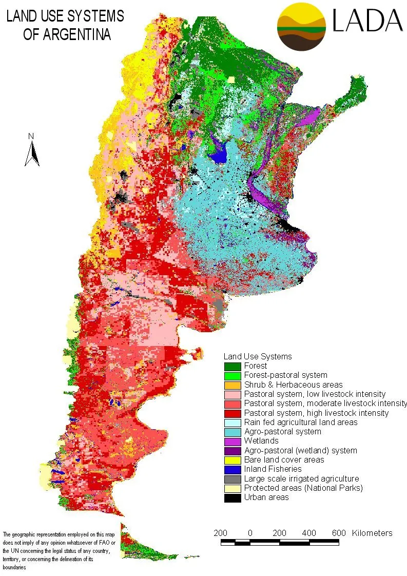
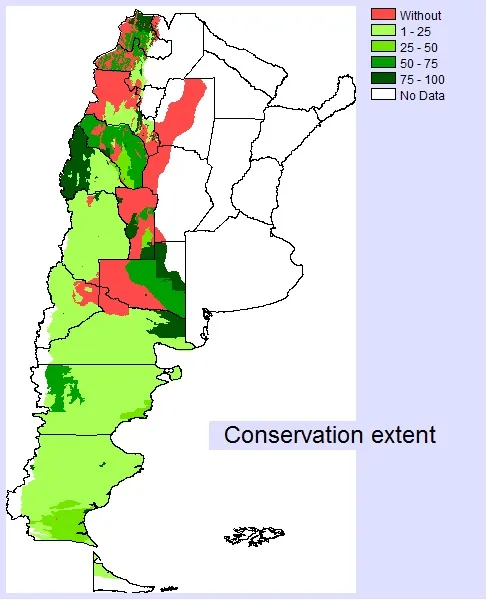
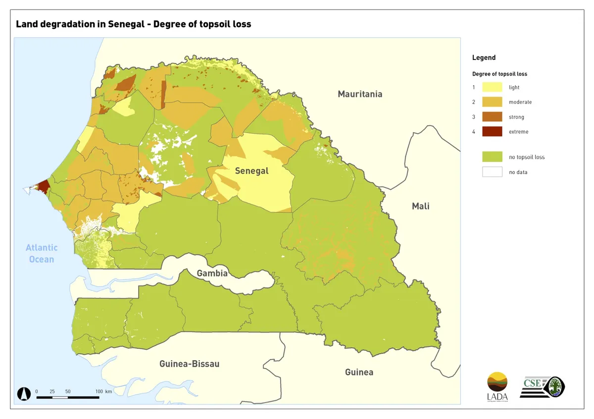
Six countries participated in the project with their national institutions: Argentina, China, Cuba, Senegal, South Africa, and Tunisia. Great importance was given to the involvement of stakeholders at all levels, using participatory approaches, expert consultations, and capacity building. At the same time, attention was given to international cooperation in combating degradation. Part of the project strategy was to support the establishment of regional land degradation training centres in the six countries, and linking these to the international environmental conventions, UNCCD, UNCBD, and UNFCCC.
The follow-up project to LADA is the Decision Support in Sustainable Land Management (DS-SLM) project of FAO and GEF.
Project results and impacts
As a global outcome, LADA developed and validated with its partners and partner countries a harmonized set of methodologies for the assessment of land use, land degradation, and Sustainable Land Management (SLM) practices at global, national, sub-national, and local levels:
- A global information system on land degradation (GLADIS)
- A comprehensive web-based indicators repository system
- A methodology and guidelines for the assessment and mapping of land degradation and land management practices at national and sub-national levels (Questionnaire Mapping, or QM) tested in six countries, and 24 local case studies
- Draft methodology for the local level assessment of land degradation and SLM practices at local level including biophysical aspects and livelihoods (LADA local)
LADA–WOCAT–DESIRE decision support methods are currently used on about 7 million km2 in at least 20 countries.
Publications
Other relevant links
WOCAT-LADA modules: Watershed Management & Climate Change Adaptation on Slideshare. Click here.
Countries
Contact
 Chile
ChileOfficial website
Project duration
2006 - 2010
Global Environment Facility (GEF)
United Nations Environment Programme (UNEP)
Central Asian Countries Initiative for Land Management (CACILM)
Mediterranean Agronomic Institute of Bari (CIHEAM/IAMB)
University of Sassari (NRD)

Global Land Cover Network (GLCN)
Global Mechanism – United Nations Convention to Combat Desertification
ISRIC – World Soil Information

Medcoastland Thematic Network

ODG/DEV – University of East Anglia
Sahara and Sahel Observatory (OSS)
Somalia Water and Land Information Management (SWALIM)
United Nations Convention to Combat Desertification (UNCCD)
United Nations University (UNU)
Agencia de Medio Ambiente (AMA), Cuba
Centre de Suivi Ecologique, Senegal
Department of Agriculture, Forestry and Fisheries (DAFF), South Africa
Direction Générale de l'Aménagement et de la Conservation des Terres Agricoles (DG ACTA), Tunisia
National Bureau to Combat Desertification, China
Ministerio de Ambiente y Desarrollo Sustentable, Argentina