ProSoil Ethiopia
Lowland Soil Rehabilitation Project implementing the Dry Valley Rehabilitation and Productive Use (DVRPU) approach in the Ethiopian lowlands
- Home
- ProSoil Ethiopia
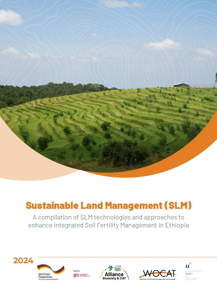
As part of the German special initiative „Transformation of Agricultural and Food Systems”, the Global Programme “Soil Protection and Rehabilitation for Food Security” (ProSoil), supports and advises smallholder farmers in Ethiopia, Benin, Burkina Faso, India, Kenya, Madagascar and Tunisia on agroecological and climate-smart agricultural practices and transformation processes focusing on sustainable land management. WOCAT has supported the documentation and exchange of best practice in the seven countries, including Ethiopia.
The Challenge
Ethiopia, a country characterised by diverse landscapes ranging from fertile highlands to arid lowlands, has a rich agricultural sector that is the backbone of its economy. The highlands cover about 45% of the country's land area and are known for their fertile soils and favourable climate, making them ideal for crop production. In contrast, the lowlands, which cover approximately 55% of the country's land area, are mostly arid and semi-arid, which presents a considerable challenge to agricultural productivity.
Despite the agricultural potential of these regions, Ethiopia's agricultural sector faces many challenges that hinder its development and sustainability. The Integrated Soil Fertility Management Project (ISFM+) and the Lowland Soil Rehabilitation Project (LSRP) are the two pillars of ProSoil Ethiopia that aim to address these challenges to improve food security, soil fertility and promote sustainable agricultural practices.
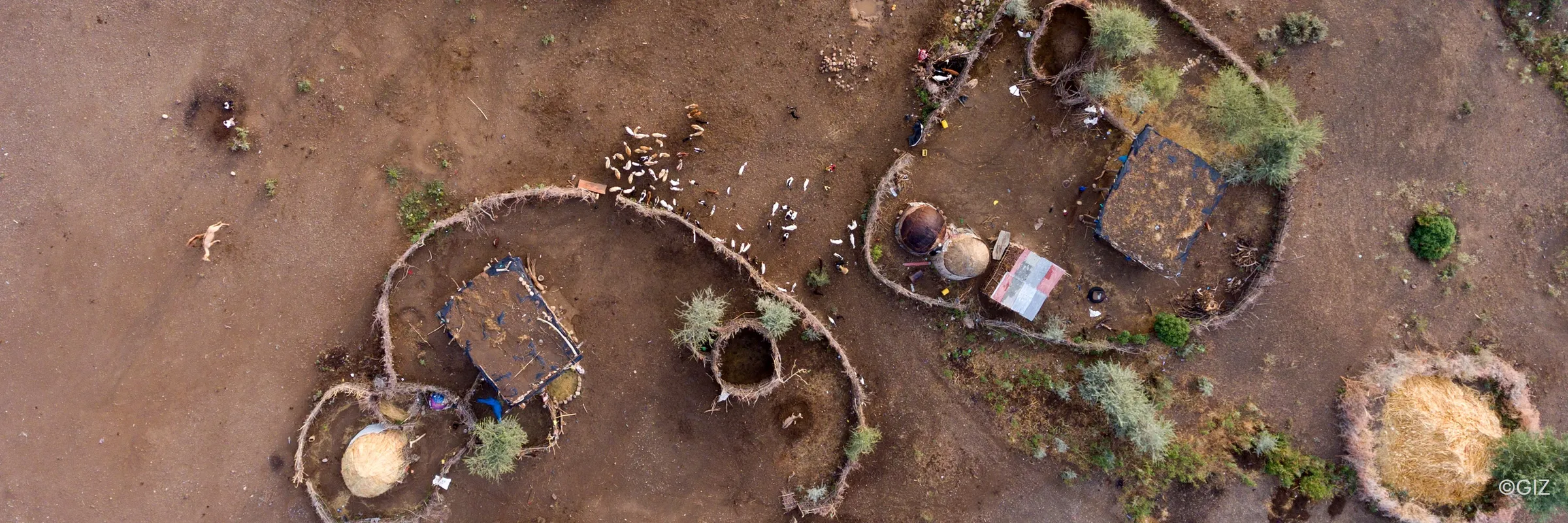
The lowlands of Ethiopia, inhabited by (agro-) pastoralist communities, are severely impacted by climate change which has led to prolonged droughts and more intense floods. This, combined with population growth and increased demand for livestock grazing, has led to the overexploitation of natural resources and widespread land degradation. The powerful floods coming from the highlands, once beneficial for the lowland areas, have now become destructive, leading to soil erosion, the formation of deep gullies, a lack of water infiltration and loss of vegetation. This has devastated the livelihoods of millions of people in the dry valleys that once thrived on tall grasses.
In the Ethiopian highlands, soil degradation is a major concern for the agricultural sector, where subsistence-oriented smallholders practice intensive farming but lack the means to replenish soil nutrients, resulting in infertile and degraded soils. Climate change, frequent droughts and population growth are exacerbating the situation and putting pressure on soil resources. To address these issues, the ISFM+ project supports the Ethiopian government in promoting Integrated Soil Fertility Management (ISFM) practices. These practices include the use of inorganic fertiliser, organic manure and lime on acidic soils, and aim to improve soil health, productivity, biodiversity and climate resilience.
The Integrated Soil Fertility Management (ISFM) Approach
The Integrated Soil Fertility Management (ISFM) approach aims to boost crop and biomass production through complementary technology packages, including organic fertilizers, soil acidity treatment, and improved crop residue management. ISFM focuses on farmers with limited means to purchase chemical fertilizers, promoting organic fertilizers to enhance soil fertility and crop productivity. It also helps farmers generate income through the production and sale of organic fertilizers and green manure seeds.
The approach includes seasonal training, exposure visits, and collective learning to improve stakeholders' understanding of land degradation and sustainable land management (SLM). Local implementation is supported by the Farmers Research and Extension Group (FREG) and the Soil Fertility Improvement Cluster, which help scale out ISFM technologies. Model Farmers assist in disseminating the approach among their peers.
The Dry Valley Rehabilitation and Productive Use (DVRPU) Approach
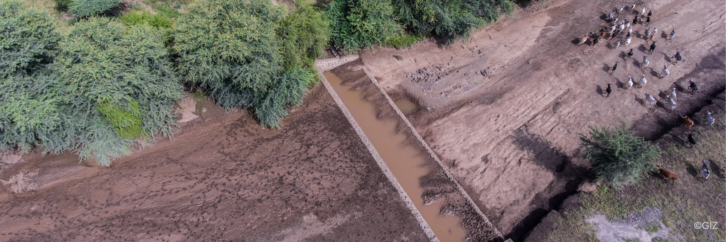
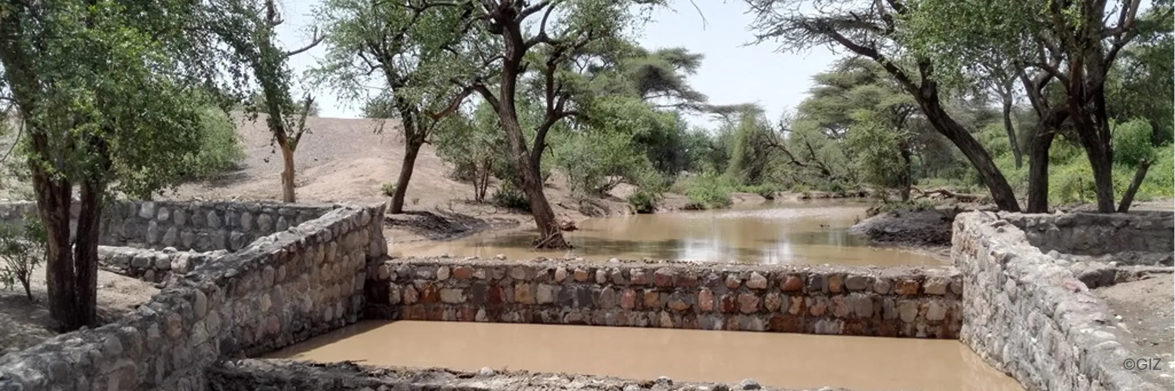
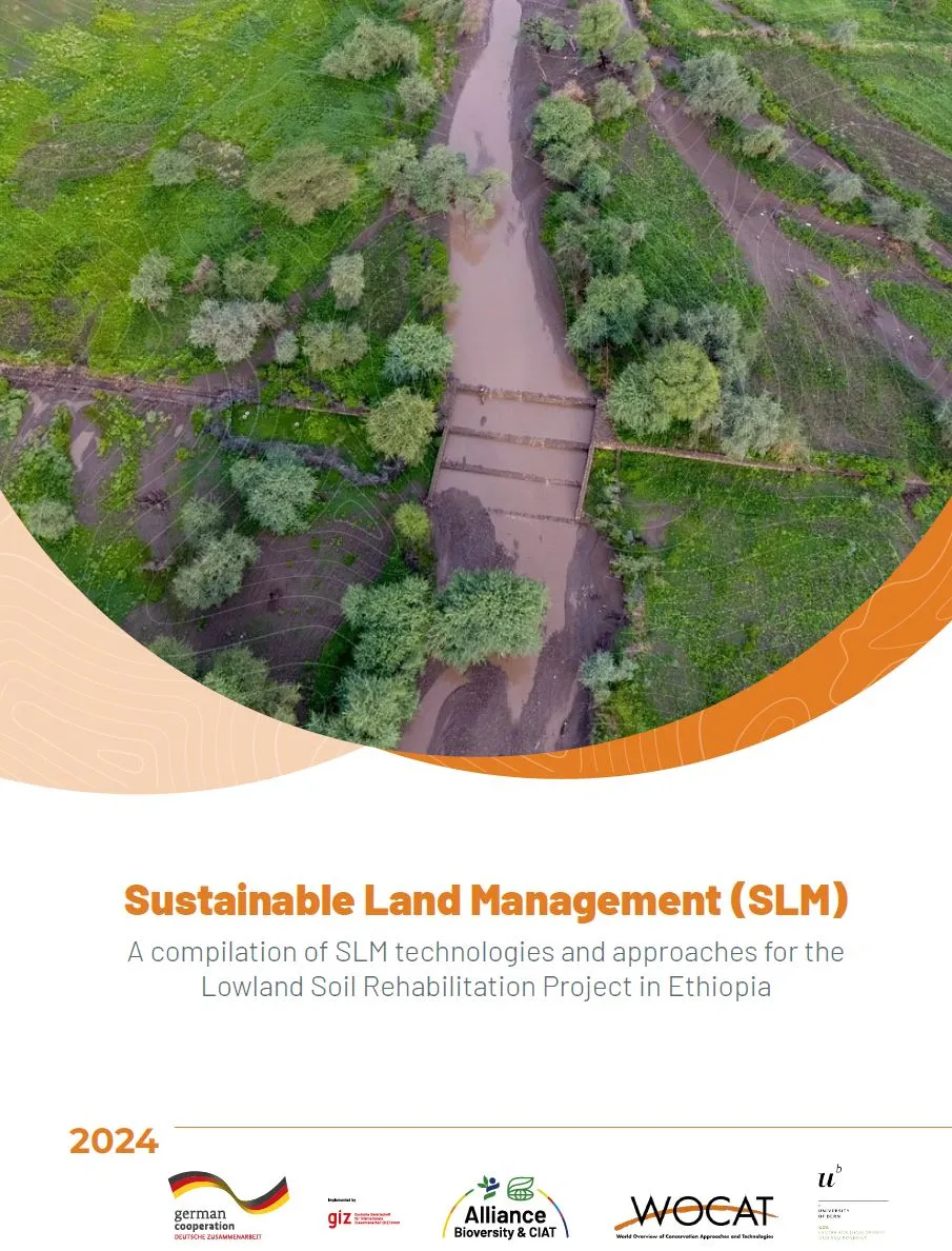
At the heart of DVRPU is a comprehensive set of measures that addresses multiple dimensions: social, technical, biological, economical, institutional, and governance - which ensures the successful rehabilitation of entire dry valleys. The core technology employed is a cascade of Water-Spreading Weirs (WSWs). These structures combined with Dry-Stone Measures (DSMs) and biological measures work together to slow down the flow velocity of the floods. By doing so, the water can infiltrate into the soils, increasing groundwater levels and allowing fertile sediment to settle, creating highly productive land and thus food security.
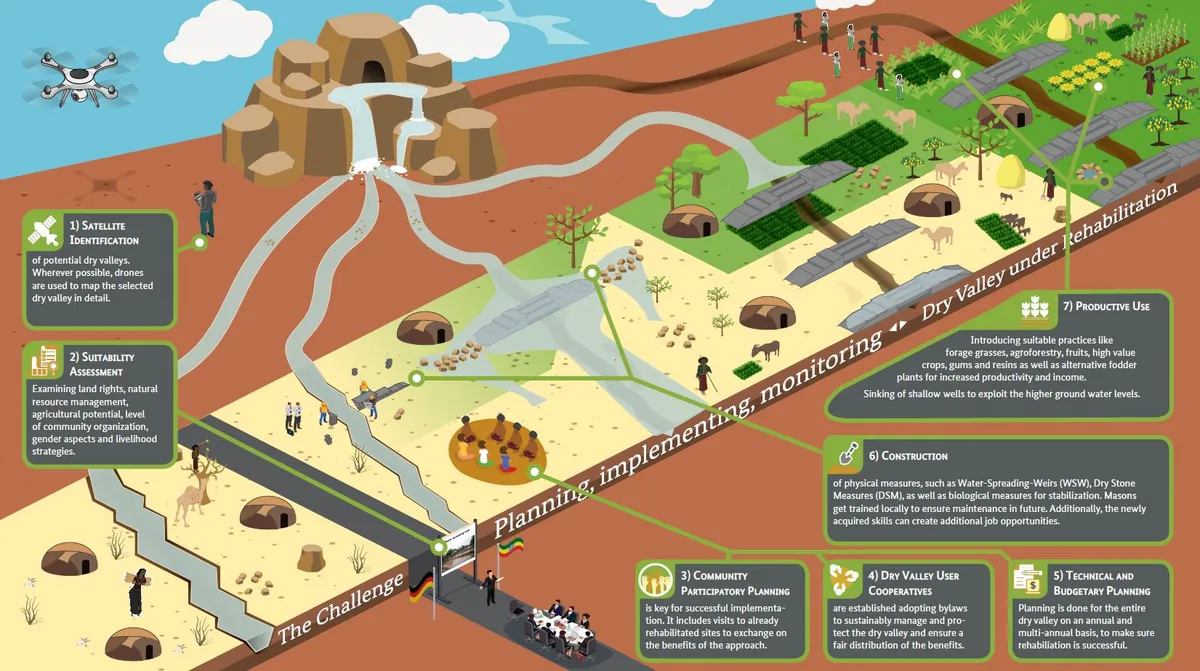
The DVRPU approach follows a 7-step process, which starts with the identification of socially and biophysically suitable sites. One key factor for the success is the acceptance and participation of local communities. Their engagement is supported by technical expertise and regulatory frameworks provided by local governments. Collaboration between communities, technical experts, and local governance is vital for the long-term sustainability of the intervention fostering active involvement in planning, implementation, maintenance and utilisation of the rehabilitated lands.
- Satellite Identification: Potential dry valleys are identified with the help of satellite or drone images. The images are then processed, and potential dry valleys delineated.
- Suitability Assessment: The potential dry valley is then checked for suitability by ground-truthing, examining land rights, land- and, natural resource management, the level of community organisation, gender aspects and livelihood strategies of the communities.
- Community Participatory Planning: an important step that proactively involves of the community from the outset and the respective governmental partners in a deliberative activity planning process. Experience exchange visits are arranged for the community and local experts to rehabilitated areas for better understanding of the approach.
- Dry Valley User Cooperatives: are established by the communities living or regularly using the dry valley. They define by-laws for the protection, management and use of the rehabilitated lands and their productive use thereof.
- Technical and Budgetary Planning: In this step a detailed technical rehabilitation plan is developed with the community and partners including a standardized budget. The planning will span a maximum of 10-years with detailed annual plans that are closely monitored.
- Land rehabilitation measures: both physical and biological technologies and approaches are used here. Physical measures include water spreading weirs (WSWs) and dry-stone measures (DMS). Important to the dry valley rehabilitation and the protection of the physical structures are biological rehabilitation measures, such as area enclosures and the planting of hardy plants, which are integrated into the overall approach.
- Productive Use: The goal of the approach is to use the rehabilitated area for productive use by introducing suitable fodder and food crops. One dry valley has the potential to create food security for 6000 people!
The Benefits
Successful implementation of DVRPU yields multiple benefits. The physical and biological measures control the floods coming down from the highlands and make them beneficent:
- creation of new and fertile lands with increased soil moisture to produce food and fodder,
- increased ground water recharge and the availability of water for domestic and livestock needs,
- shallow wells for irrigation, and
- mitigation of flood damage for downstream investment.
The structures spread the floods to the adjacent rangelands, fertilising them through flood sediments:
- low input agriculture with late and multiple harvests,
- allows for crop diversification, including high value crops,
- zero risk to salinity and acidification,
- a more resilient system compared to rainfed agriculture, and
- reduced pressure on surrounding natural resources.
