Approaches
Participatory Understanding of Groundwater Dynamics: Threats and Responsive Management [India]
Participatory Understanding of Groundwater Dynamics: Threats and Responsive Management
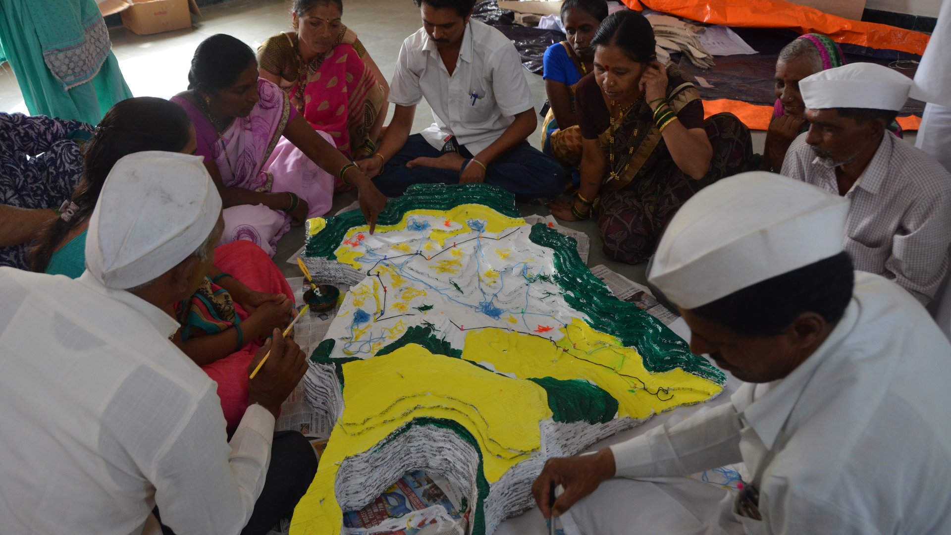
CDVI 3D Model
- Creation:
- 2025-05-26 11:23
- Updated:
- 2025-06-17 09:33
- Compiler:
- Pratik Ramteke
- Editors:
- –
- Reviewers:
- Rima Mekdaschi Studer, William Critchley
Links
No links