Sorting by "Updated at"
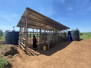
Rainwater Harvesting to Address Prolonged Drought: Advancing Gender Equality and Strengthening Community Resilience [Rwanda]
This technology captures rainwater from the roofs of cattle shelters at the farms, and stores it in tanks of 50 cubic meters capacity. This is complemented with tree planting where roots provide stabilisation of the soil, and mulching to maintain moisture in the soil. These measures reduce soil erosion and prevent the loss of nutrients by keeping the soil moist and holding it in place.. It provides enough water storage to start the agricultural season on time even during drought conditions and continue irrigation throughout the season when rainfall is not sufficient.
- Compiler:
- Miri Heatherwick
- First published:
- 2026-09-28 09:18
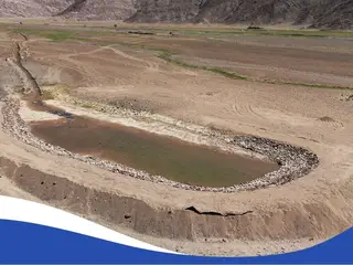
Gravity-fed plastic-lined water retention pond with river headworks [Mongolia]
This Technology is an integrated, gravity-fed surface-water diversion, storage and distribution system that captures part of the seasonal flow of the Uliastai River for use during periods of water scarcity. The stored water supports livestock watering and small-scale irrigation of fodder and pasture areas, while helping reduce pressure on heavily used natural watering points and the risk of further rangeland degradation.
- Compiler:
- Undarmaa Dagvasuren
- First published:
- 2026-08-10 09:00
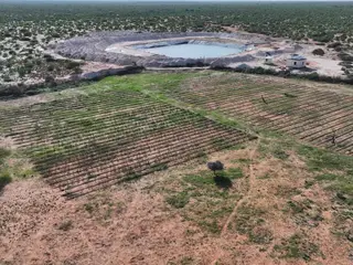
Kaluun-Dacar Water Harvesting Haffir [Somalia]
A water harvesting haffir constructed by the Barwaaqo Project in Kaluun-Dacar village, Galmudug State, designed to capture and store seasonal surface runoff from the Gu and Deyr rains for livestock, household use, and small-scale fodder production, while reducing soil erosion and enhancing drought resilience.
- Compiler:
- Abdulkadir Ali Mohamed
- First published:
- 2026-06-21 15:07
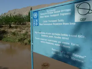
Rehabilitation of iron water gates to improve distribution of irrigation water [Tajikistan]
The recycling of broken iron water gates which can be used to regulate the water flow into smaller side canals were reconstructed along the main irrigation canal.
- Compiler:
- Natalia Mityakova
- First published:
- 2017-03-15 14:08
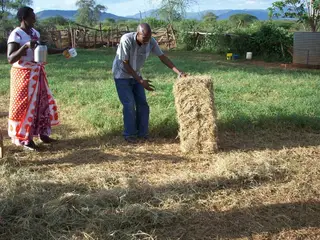
Soil and water conservation through pasture regeneration and hay production [Kenya]
In this new technology the Maasai people set aside some acres of land, fence it and plant grass where the land is bear or allow natural standing grass to germinate then harvest it and store as hay for future use. This also helps in preventing soil erosion and surface run off.
- Compiler:
- SAIKO JOYCE
- First published:
- 2018-05-22 06:32
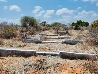
Soil and water conservation and pasture management through check dams and fencing [Somalia]
A soil and water conservation and pasture management technology implemented through area closure, fencing, and installation of check dams to control erosion and rehabilitate degraded rangelands.
- Compiler:
- salad ali
- First published:
- 2026-04-26 11:02
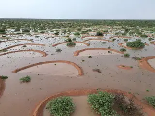
Soil and Water Conservation through Half-Moon Structures [Somalia]
The micro half-moon catchment (Bila Bilo) of Beyra is a soil and water conservation technology that harvests runoff, reduces erosion, and improves water infiltration in dryland areas. By capturing sediments and retaining soil moisture, it creates fertile micro-sites that support vegetation regeneration, land restoration, and climate change adaptation.
- Compiler:
- Faruq Dahir
- First published:
- 2026-04-26 11:02
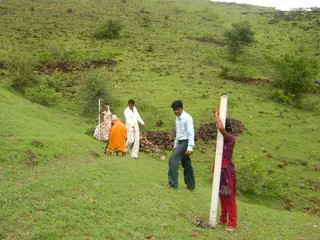
Participatory Net Planning for Sustainable Watershed Management [India]
Participatory Net Planning (PNP) is a practical methodology that actively engages landowners and local stakeholders in planning and implementing measures for land use, soil conservation, water harvesting, and biomass development. It aims to regenerate ecosystems and improve the sustainability of watersheds through site-specific resource management. PNP emphasizes the conservation, productivity enhancement, and sustainable use of natural and biological resources. It involves assessing the current condition and use of land, water, and vegetation, and preparing detailed plans—with estimated costs and timelines—to achieve the desired outcomes. In Participatory Net Planning (PNP), the term “Net” represents a complete and interconnected planning framework where every land parcel within a watershed is individually assessed and linked to the larger watershed system. It highlights a network-based approach that integrates soil, water, vegetation, and community needs, ensuring that interventions on one farm support resource conservation and productivity across neighboring and downstream lands. Overall, it signifies a holistic and coordinated system where all stakeholders and resources are planned collectively for sustainable and long-term watershed management.
- Compiler:
- Arun Bhagat
- First published:
- 2025-12-06 16:34
Capacity Building Process for Participatory Watershed Development [India]
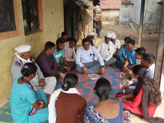
The Capacity Building Process for Participatory Watershed Development is a structured approach to strengthen the technical, managerial, and social skills of Non-Governmental Organizations (NGOs), Partner Implementation Agencies (PIAs), and Village-level Institutions (VIs). It includes orientation, training, participatory tools, mentoring, exposure visits, monitoring, and institutionalization. The process enhances competencies, fosters creativity and confidence, promotes community ownership, and ensures effective, sustainable planning, implementation, and management of watershed-based natural resource management and climate-resilient interventions.
- Compiler:
- Arun Bhagat
- First published:
- 2025-11-21 17:54
Agroforestry to improve soil fertility, water retention, and sustainable income for local communities [Afghanistan]
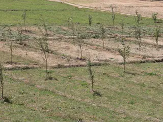
The Agroforestry system in Malistan district combines traditional practices with support from the Community-Based Sustainable Land and Forest Management project in Afghanistan. This initiative provides technical support, training, and resources like apple trees, fertilizers, and alfalfa seeds to establish 400 orchards (1,000 m² each). The goal is to enhance community livelihoods by reducing dependence on rangelands, helping to preserve local ecosystems.
- Compiler:
- Ahmad Zia Jalalzai
- First published:
- 2025-11-04 09:08
Experiential Learning Tools for Sustainable Water Management [India]
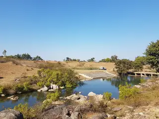
The project “Scaling up experiential learning tools for sustainable water governance in India” aimed at enhancing sustainable water management at scale by improving the capacities of 1,500 rural communities covering 105,000 households directly and 2,000 communities covering 140,000 households indirectly in six Indian states to manage water more sustainably. This was achieved through experiential learning from collective action games, structured community debriefings, and participatory water planning tools that contribute to greater awareness and improved governance, inducing behavioural change toward more sustainable water governance and management. The work was jointly conducted by the Foundation for Ecological Security, India (FES), the International Food Policy Research Institute (IFPRI) and the International Crops Research Institute for the Semi-Arid Tropics (ICRISAT).
- Compiler:
- Vishwambhar Duche
- First published:
- 2025-03-26 23:13
Water-conservation technology at cultivation of the cotton in south. K [Kazakhstan]
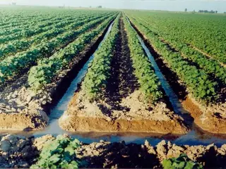
The technology of watering through furrow reduces the settlement (recommended) sizes of irrigating norms up to 30% keeps soil fertility
- Compiler:
- Unknown User
- First published:
- 2017-05-26 11:32
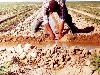
Watering through furrow [Kazakhstan]
Watering through furrow
- Compiler:
- Unknown User
- First published:
- 2017-07-17 15:39
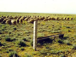
Creation of sowed pastures from subshrubs and forbs able to use maximally the scanty water resources [Kazakhstan]
Increase of use effectiveness of limited resources of soil moisture in desert with sowing xerophyte fodder plants
- Compiler:
- Irina Skorintseva
- First published:
- 2017-07-17 17:38
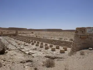
Cross-Wadi Water Harvesting Structures [Saudi Arabia]
Cross-wadi structures are built from local stone to slow the flow of runoff. These water harvesting walls reduce the severity of storm flow, causing sedimentation and a rise in the water table level. Productive trees can be planted as a result.
- Compiler:
- Abdalhaleem Hassaballa
- First published:
- 2026-04-23 08:17
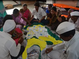
Participatory Understanding of Groundwater Dynamics: Threats and Responsive Management [India]
CoDriVE-VI is a participatory approach that integrates local knowledge with scientific data through 3D visual modelling to assess groundwater vulnerability and support sustainable, community-based groundwater management. It overlays surface and subsurface features, enabling villagers to visualize aquifer systems and develop informed water use plans.
- Compiler:
- Pratik Ramteke
- First published:
- 2025-06-16 09:27
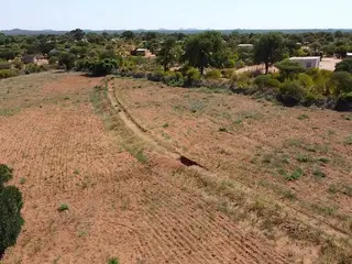
Contour Rainwater Harvesting Trenches [Zimbabwe]
A trench is a shallow excavation made in the ground to harvest rainwater, control runoff flow, reduce soil erosion, and improve soil moisture retention. Trenches are typically surveyed and designed based on the slope, soil type, and rainfall patterns of the area where they are implemented.
- Compiler:
- Koetlisi Koetlisi
- First published:
- 2025-06-02 10:53
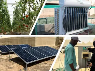
A Water-Energy-Food (WEF) efficient net house [United Arab Emirates]
The technology integrates off-grid soil-less cultivation within a net house, utilizing solar-powered root zone cooling and ultra-low energy irrigation, thus significantly enhancing water and energy efficiency for sustainable agriculture in arid regions. This innovation is a key contribution within the Water-Energy-Food Nexus, addressing the unique challenges of food production in the Middle East.
- Compiler:
- Joren Verbist
- First published:
- 2024-12-01 09:19

Maintenance of forest cover in headwaters [Belgium]
Forests in headwater areas benefit water quality and hydrologic cycling. Furthermore, maintaining and restoring the forest cover in headwater catchments offers other, multiple benefits such as increased soil water retention, intercepted pollution pathways, improved soil, maintained biodiversity and captured carbon dioxide.
- Compiler:
- Marie Anne Eurie Forio
- First published:
- 2024-09-15 09:08
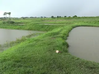
Ground water fed fish ponds [Uganda]
Fish farming supported by availability of water is considered as profitable enterprise in Northern Uganda. Farmers use areas with either high water tables or swamps to locate the ground water recharged fish ponds and water for fish production and crop irrigation during the dry season.
- Compiler:
- Kamugisha Rick Nelson
- First published:
- 2018-08-21 14:45
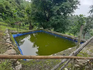
Low-Cost Plastic-Lined Water Harvesting Pond [Bhutan]
Low-cost plastic-lined water harvesting ponds collect and store rain and overland flow water for agricultural and domestic purposes in the dry season. They are both economic and efficient.
- Compiler:
- Nima Dolma Tamang
- First published:
- 2024-03-26 12:22
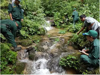
Sustaining Drinking Water through Payment for Environment Services (PES) [Bhutan]
This approach compensates land users annually for taking care of a water source and its surroundings. The source is being looked after by two groups of environmental service providers and water is supplied to seven gewogs and Damphu Municipality in the Tsirang Dzongkhag.
- Compiler:
- Tshering Yangzom
- First published:
- 2024-01-25 09:24
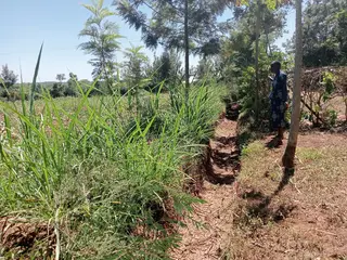
Retention ditches for soil and water conservation [Kenya]
Retention ditches are channels aligned along the contour which are designed for surface runoff management. They improve water infiltration into the ground and prevent soil erosion.
- Compiler:
- William Akwanyi
- First published:
- 2023-07-10 11:03
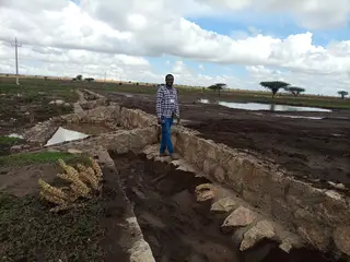
Water Spreading Weirs [Ethiopia]
Water Spreading Weirs are designed to protect the degradation of agricultural fields and rangelands. They contribute to soil and water conservation and enhance the productive use of dry valleys for food crops and livestock fodder production via the harvest and spread of runoff water and fertile soils.
- Compiler:
- GERBA LETA
- First published:
- 2023-04-27 18:23
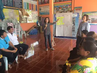
Project for preventing soil salinity lowering the groundwater tables [Thailand]
The Land Development Department has promoted lowering of saline groundwater table in recharge areas since 2014. The approach used is through: (1) Public relations and information spreading; (2) Planning demonstration sites; (3) Selection of farmers interested in participating in the project; (4) Providing knowledge and advice to those farmers participating in the project; (5) The preparation of demonstration plots, with shallow wells, in farmers' land.
- Compiler:
- Saowanee Prachansri
- First published:
- 2024-04-04 14:20
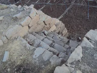
Building Walls's stones to protect lands and building outlet to drain excess water [Yemen]
use the stones to build walls around agricultural terraces to protect them from erosion and make outlets (Spillway) to discharge excess water and prevent the destruction of the stands
- Compiler:
- ahmed algalal
- First published:
- 2017-06-24 14:12
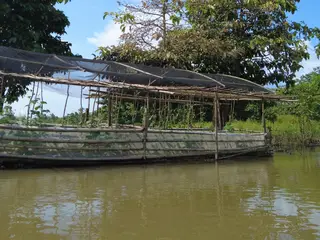
Floating Vegetable Garden Using Water Hyacinth as Planting Medium [Philippines]
Floating vegetable garden as a climate change adaptation strategy for the indigenous communities living in the wetland of Agusan del Sur to grow vegetables during the flooding season.
- Compiler:
- Philippine Overview of Conservation Approaches and Technologies
- First published:
- 2024-02-27 09:43
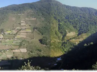
Water Source Protection [Bhutan]
Water source protection involves protecting lakes, rivers, springs, or man-made reservoirs to avoid water pollution and damage by livestock and wild animals. In the past, the emphasis was on fencing and improving vegetation cover at the discharge point itself, but a recent focus is on groundwater recharge areas.
- Compiler:
- ONGPO LEPCHA
- First published:
- 2024-02-28 17:37
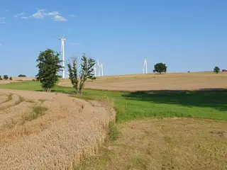
Grassed waterways [Germany]
A grassed waterway is a strip of grass and other permanent low growing vegetation that is established along in the main drainage line (the thalweg) of an agricultural field to discharge water safely and prevent gully development.
- Compiler:
- Felix Witing
- First published:
- 2023-08-15 08:54
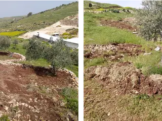
Rainwater Harvesting for Olive Production [Palestine]
Microcatchment water harvesting captures, stores and allows safe overflow of excess surface runoff collected during heavy rainfall events. The intercepted and deep-infiltrated water enhances soil moisture at/around the microcatchment structure. This eventually boosts plant productivity in dry areas, mitigates land degradation, and benefits the local farming communities’ livelihoods
- Compiler:
- Joren Verbist
- First published:
- 2023-05-25 12:11
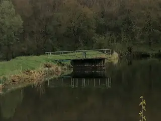
Water retention/sediment capture pond [Hungary]
Sediment capture ponds are constructed and located along networks of ditches which drain watersheds. They slow the velocity of water and cause the deposition of suspended materials. These ponds help to avoid sediment accumulation in the ditches themselves, and can decrease sediment and nutrient pollution of surface water bodies downstream.
- Compiler:
- Brigitta Szabó
- First published:
- 2023-04-24 11:13
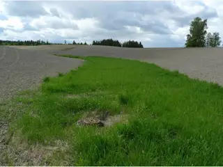
Grassed waterways [Norway]
Grassed waterways are shallow channels (natural or constructed) with grass cover, used to drain surface runoff from cropland and prevent erosion.
- Compiler:
- Dominika Krzeminska
- First published:
- 2022-06-27 18:20
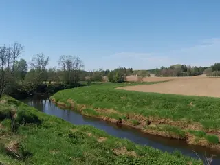
Grass buffer zones alongside waterways in cropland [Norway]
Grass buffer zones are established along waterways in cropland to reduce the surface runoff rate, and the amounts of sediment, nutrients and pesticides in the runoff.
- Compiler:
- Kamilla Skaalsveen
- First published:
- 2017-03-16 09:56
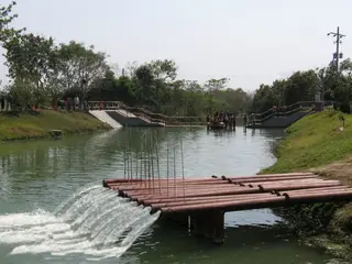
Mainstreaming river water to facilitate irrigation in Barind [Bangladesh]
The technology promotes the lifting of river water by pump sets and conveys the water through buried pipelines to a canal. The conserved canal water is used for irrigation delivered by low lift pumps (LLP). Because water is held in the canal it revitalises the ecosystem along its length. Furthermore, using river water for irrigation avoids dangers associated with groundwater depletion.
- Compiler:
- Jalal Uddin Md. Shoaib
- First published:
- 2022-12-19 17:28
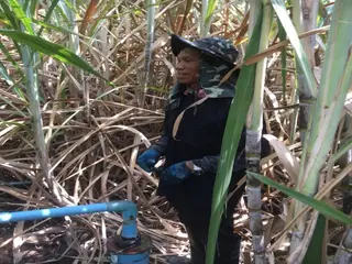
Using shallow wells for crops and lowering the saline groundwater table [Thailand]
Pumping groundwater from shallow wells for agriculture can control the groundwater table in recharge areas. It helps to manage saline aquifers and reduce soil salinity. Such shallow wells range from 25 to 30 meters deep. This technology is very well-accepted by the land users.
- Compiler:
- Kaewjai Oechaiyaphum
- First published:
- 2022-12-05 09:32
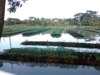
FLOATING AGRICULTURE IN WATERLOGGED SOIL [Bangladesh]
The aim of this technology is to use the waterlogged soils, which remain under water during 6 to 7 months of a year, for vegetable seedlings. This is done through floating seed beds which are made of water hyacinths.
- Compiler:
- Naznin Imrana
- First published:
- 2022-11-18 11:15
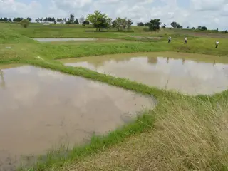
FISH FARMING (AQUACULTURE) FOR INCOME GENERATION AND WATER CONSERVATION [Uganda]
Fish farming, commonly referred to as aquaculture, is one of the common practices promoted by small, medium and large scale farmers in Amuru District, Northern Uganda. Labour, hoes, wheelbarrows, spades and slashers are used for establishment. The technology is established on a gently sloping physical environment located mainly at the valley bottom for purposes of obtaining food security and household income.
- Compiler:
- betty adoch
- First published:
- 2022-11-02 10:00
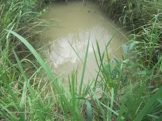
SPRING GROUND WATER RESERVOIR FOR WATER SUPPLY AND FISH PRODUCTION [Uganda]
Spring ground water reservoir to supply water for the fish pond during dry season to be harvested throughout the year.
- Compiler:
- betty adoch
- First published:
- 2022-10-24 13:10
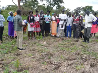
Conservation Farming Basins In Annual Crops For Water Conservation [Uganda]
CF basins are constructed in the field to act as water storage containers. Water is conserved within the basins and plants can survive with this conserved water during periods of little rainfall and dry spells.
- Compiler:
- Sunday Balla Amale
- First published:
- 2020-04-16 13:52
Earth dam for stockwater [South Africa]
Construction of earth dams to provide stock water
- Compiler:
- Jannie Nel
- First published:
- 2017-04-14 13:57
- . . .