
Land Degradation Neutrality in Ecuador
The LDN Ecuador project is an initiative of the Ministry of Environment, Water, and Ecological Transition (MAATE) and the Ministry of Agriculture and Livestock (MAG). It is funded by the Global Environment Facility (GEF) and implemented by CONDESAN, under the technical supervision of the Food and Agriculture Organization of the United Nations (FAO). WOCAT is supporting the project to strengthen national land degradation monitoring capabilities as part of a process to establish a national LDN strategy and set National LDN targets.
- Home
- Land Degradation Neutrality in Ecuador
About the project
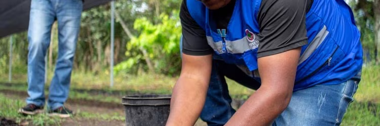
The LDN (NDT) Ecuador project aims to address land degradation processes to promote sustainable development in rural areas of Ecuador. Over the period of 2022-2026, the project focuses on preventing, reducing, and reversing land degradation to ensure the provision of key ecosystem services and food sovereignty.
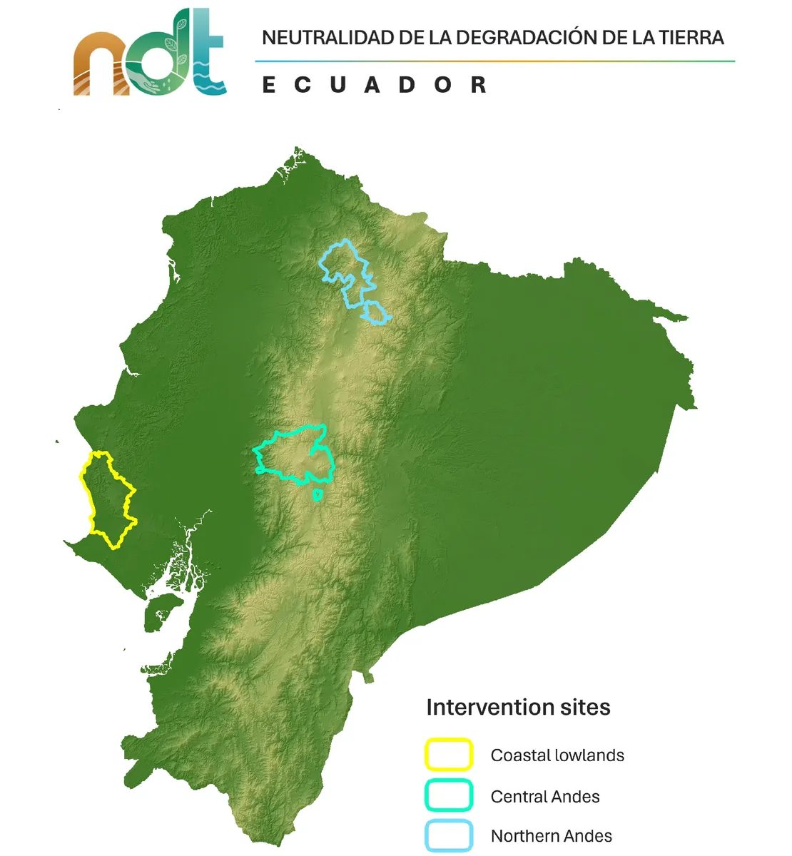
Implemented across three intervention sites, including the Northern Andes, Central Andes, and Coastal lowlands, the project targets forests, páramos, and agricultural lands. The project seeks to strengthen the enabling environment for setting LDN targets and monitoring LDN approaches to promote resilient livelihoods, and fostering innovative incentive mechanisms. The participatory assessment of land degradation and the development of a national strategy for LDN involve collaboration among various institutions, emphasizing a comprehensive approach to sustainable land and forest management practices. Through these efforts, the project endeavors to contribute to the overarching goal of achieving Land Degradation Neutrality in Ecuador.
Towards a National LDN Action Plan
Within the framework of the NDT project, the government of Ecuador has initiated a process for developing a national Land Degradation Neutrality (LDN) action plan. This comprehensive endeavor involves active participation from academia, non-governmental organizations (NGOs), and various ministries and secretaries of the government. The plan will encompass the development of national voluntary LDN targets, reflecting a collective commitment to addressing land degradation challenges and promoting sustainable land management practices across Ecuador. By engaging diverse stakeholders and fostering multi-sectoral collaboration, the government aims to ensure the effectiveness and inclusivity of the LDN action plan, laying a solid foundation for achieving land degradation neutrality goals nationwide.
WOCAT's contribution
WOCAT plays a pivotal role in supporting the development of a baseline and monitoring strategy to track progress towards LDN, identify hotspots of land degradation and co-design a decision support system for LDN. These are key inputs for the design of the national Land Degradation Neutrality (LDN) action plan in Ecuador, particularly for setting spatially explicit LDN targets. As part of this effort and based on previous experiences around the world, WOCAT facilitates a participatory process aimed at identifying the most effective datasets and methodologies for mapping and monitoring land degradation that are adapted to the different local conditions. This collaborative approach ensures that stakeholders from various sectors are actively involved in decision-making processes, thereby enhancing the plan's comprehensiveness and effectiveness. Furthermore, this participatory process lays the groundwork for establishing an institutionalized monitoring system to track progress towards LDN, providing a robust framework for ongoing evaluation and adaptation of strategies to achieve land degradation neutrality in Ecuador.
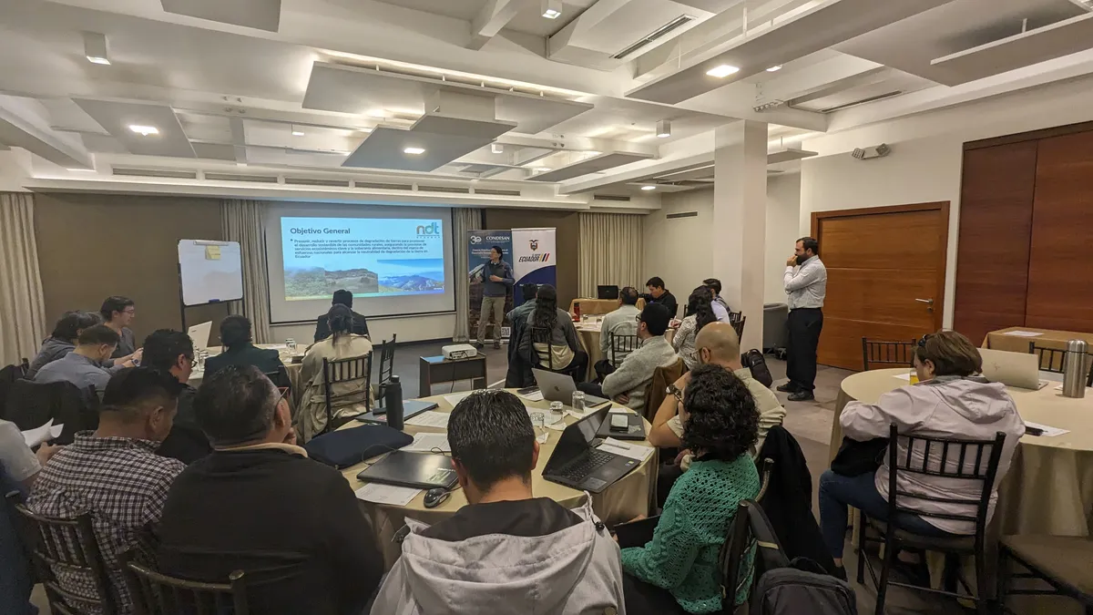
As part of the participatory assessment of land degradation in Ecuador, several virtual workshops were held during 2023 and 2024 and an in-person workshop was held in March 2024 in Quito. In this workshop experts from various institutions defined a national strategy to estimate the LDN indicators.
Land Degradation Observatory for LDN monitoring and SLM in Ecuador
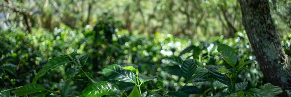
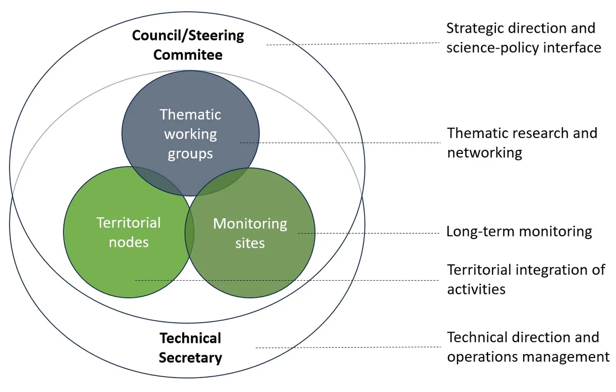
In Ecuador, multiple academic and public stakeholders study land degradation and SLM practices within highly diverse socio-ecological contexts. The LDN Project started to connect these stakeholders within a Land Degradation Observatory to identify and strengthen synergies, collaboratively build methodologies, leverage capacities, and showcase their work for decision-making and future research. The Observatory emerges as a research network linked to universities and public institutions that focus on monitoring land degradation and recovery, designing sustainable land management practices, knowledge exchange, and decision-making tools. The members are organized into broader landscapes or territorial nodes within which integrated monitoring sites at the local level are designed to analyse the dynamics of biophysical variables in different specific contexts of land degradation and sustainable land management practices. Additionally, work groups focused on specific topics are formed, including remote sensing, water resources, soils, and others. Through the network, monitoring protocols will be developed, as well as research agendas and a website.
Subnational approach
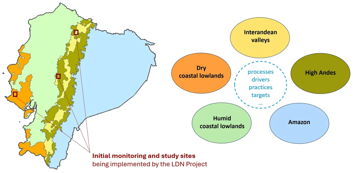
Given the geographic diversity of Ecuador, the country has been divided into five zones to facilitate more specific monitoring, reporting, target setting, and policy advice at the subnational level. These zones represent the essential territorial nodes within the Observatory’s structure and differ mainly by bioclimatic conditions, sociocultural settings, and typical agricultural land-use patterns.
Workshop Presentations and Informational Content
This document provides a comprehensive perspective on addressing soil degradation through Land Degradation Neutrality (LDN), framed within the Sustainable Development Goals, particularly SDG 15.3.1. It highlights the importance of sustainable management and effective monitoring of land as means to preserve natural capital, ensure food production, and protect terrestrial ecosystems. The need to adopt multidisciplinary approaches and innovative solutions that respond to the specific challenges of Ecuador is emphasized, underlining how these strategies directly contribute to achieving the environmental, economic, and social sustainability proposed by the SDGs.
In this presentation, we will meticulously examine the issue of land degradation within the Ecuadorian context, emphasizing the importance of rigorous monitoring and evaluation of key indicators for advancing environmental sustainability and progress towards sustainable development. Techniques and methodologies specifically adapted to the unique conditions of Ecuador will be introduced, aiming to enhance understanding and effective intervention capabilities in addressing this issue. The discussion will focus on fundamental aspects such as land cover, productivity, and carbon stores, which are vital for biodiversity conservation and the sustenance of essential ecosystem services.
Partners
Funded by
Contact
 Argentina
 Argentina
 Ecuador
 Ecuador
Project duration
2022-2025
Official webpage
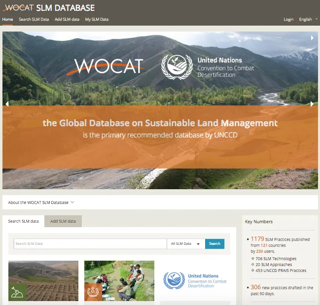
SLM practices implemented in Ecuador and documented in the Global WOCAT SLM Database
Apps for Convergence of Evidence
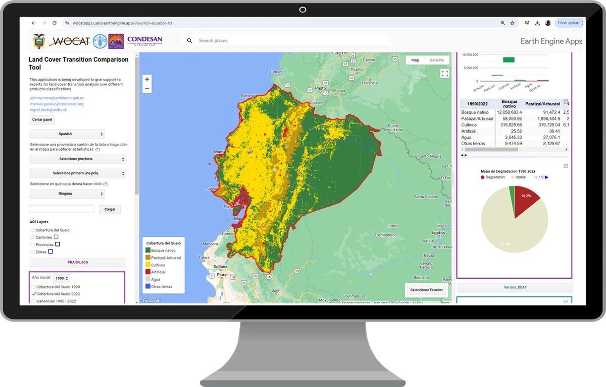
This App allows to compare alternative land cover classifications to monitor degradation due to land cover change
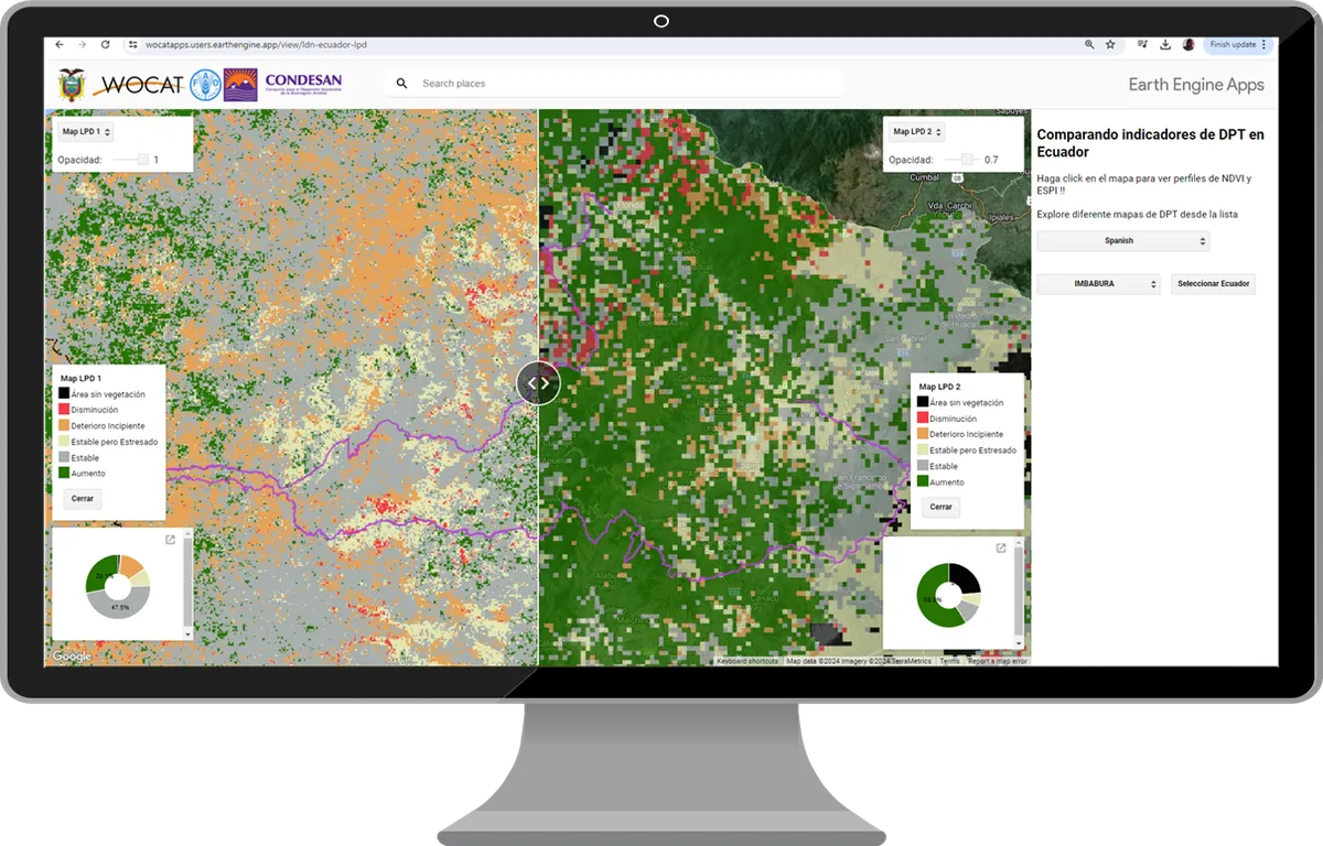
This App allows to compare alternative land productivity dynamics datasets
Learning materials
Coming soon!
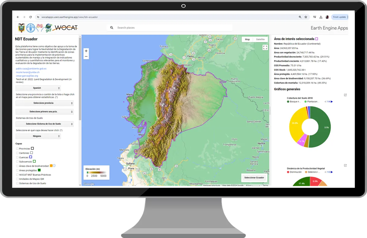
This App allows to explore and integrate different maps and datasets related to land degradation, climate change and biodiversity to identify and prioritize areas for restoration and set national commitments.
South South Knowledge Exchange in LAC
Check out the video on the Workshop held in 2023 for South South Knowledge exchange in LDN and SLM.